


NDMA launches digital hazard mapping tool at Trade Fair

By Delisa Magagula
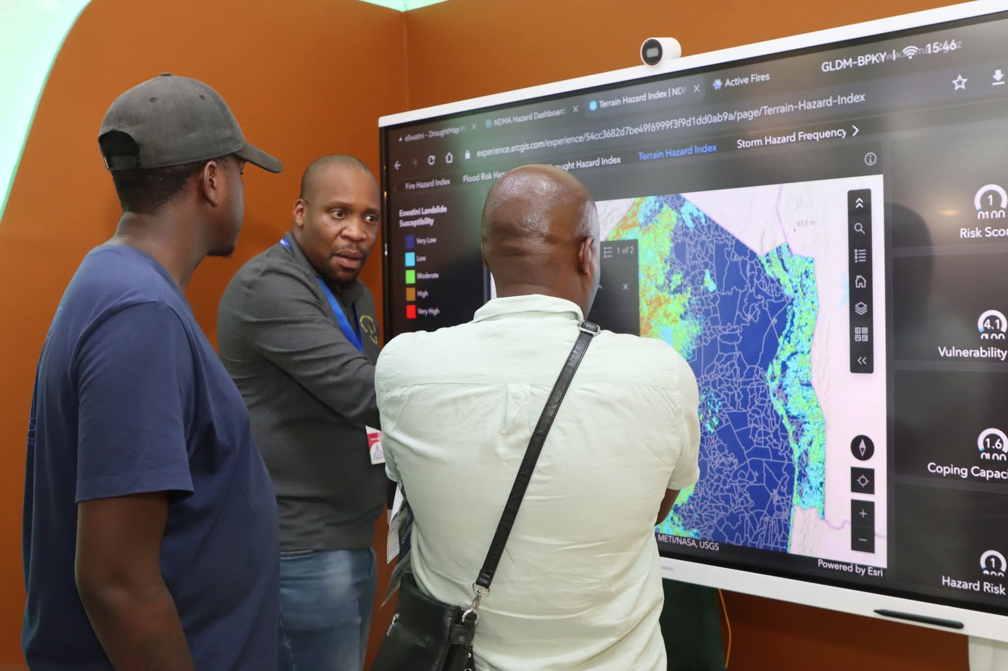
The National Disaster Management Agency (NDMA) has introduced a new digital platform that maps disaster risks across Eswatini in real time.
The tool, which was launched during the currently ongoing Eswatini International Trade Fair, allows the public to view hazards such as floods, droughts, fires and storms with unprecedented clarity.
According to NDMA Communications Officer, Magman Mahlalela, the initiative is a breakthrough in how the country prepares for disasters.
“For the first time, citizens can access hazard information in a way that is both simple and practical. This tool will allow people to make informed choices about where to live, where to farm and where to invest. It takes risk management from the level of government reports and brings it directly into the hands of the nation,” Mahlalela said.
At the Trade Fair, the NDMA stall has drawn hundreds of visitors eager to see the new system in action. Using a Virtual Reality (VR) headset, visitors are transported into simulated environments of floods, wildfires, drought conditions and storms.
The aim, Mahlalela explained, is to create awareness by letting people experience the dangers that disaster-prone communities face every year.
“When people see risk on paper, it does not always connect. But when they stand inside a VR simulation of a raging flood or a spreading fire, they understand what is at stake. They also understand why prevention and resilience are necessary,” he said.

Public reaction has been positive, with many Trade Fair attendees describing the exhibition as both eye-opening and educational. Parents, students, business owners and farmers all appreciated that the NDMA is making risk data more accessible.
The digital map is designed to go beyond exhibitions. Once rolled out nationally, it will be available online for use by individuals, companies and institutions.
The system will allow citizens to type in a location and instantly see the level of hazard exposure in that area. Farmers will be able to use the data to choose where to plant crops or how to manage irrigation systems.
Builders will be able to check if a potential construction site is exposed to flooding or fire hazards. Investors will have access to environmental risk profiles that can guide development decisions.
“Resilience is no longer just about government agencies responding after a disaster, it is also about giving people the power to prevent disasters by making smarter choices before they occur,” Mahlalela noted.
Worth noting is that Eswatini has faced repeated climate-related shocks in recent decades. Droughts linked to El Niño cycles have threatened food security, while heavy rains and floods have damaged infrastructure. Wildfires are a recurring problem in both rural and urban areas.
According to NDMA, these hazards have placed a heavy financial burden on the state, while also affecting livelihoods and businesses. By introducing the digital hazard mapping tool, the agency hopes to shift the country from a reactive posture to a preventive one.
Mahlalela emphasised that prevention is cheaper and more effective than recovery.
“Every year we spend resources on emergency relief after disasters have already happened. With this tool, we are saying let us spend resources on preparedness and risk reduction. If citizens know where the dangers are, then losses can be avoided before they occur,” he said.
Government planners are expected to make extensive use of the system. Urban development authorities can use the hazard maps to decide where to expand residential areas or where not to permit construction. Agricultural planners can align land-use policies with areas that are less exposed to drought.
The NDMA believes this will also support Eswatini’s long-term development goals. The digital hazard mapping tool can be integrated into the country’s climate adaptation plans and national resilience frameworks.
“Disaster risk is no longer an isolated issue, it is linked to the economy, to food production, to housing, and even to insurance. By making this information open and visible, we are helping every sector of society to plan better,” Mahlalela explained.
The hazard mapping system will undergo further testing before being made fully accessible to the public. Once launched, the NDMA plans to run awareness campaigns in communities, schools and business chambers to demonstrate how the platform works.
In addition, the agency is working with regional and international partners to ensure the data remains up to date. This includes partnerships with meteorological services, satellite data providers and research institutions.
Mahlalela said the long-term vision is to integrate the tool with early warning systems. This would mean that when a storm or flood is forecast, citizens could log on and see precisely which areas are most at risk.
The launch of the tool at the Trade Fair represents a major milestone for Eswatini. It is the first time that disaster risk information has been presented in such a public, interactive and practical manner.
Mahlalela concluded that the NDMA is determined to ensure that resilience becomes part of everyday life.
“Disasters do not have to destroy lives and livelihoods. With the right information, with prevention and preparedness, we can save both lives and money. This tool is one step towards a safer and stronger Eswatini,” he said.